🚚 Free Worldwide Shipping on All Orders!Shop Now
Ordnance Survey Maps
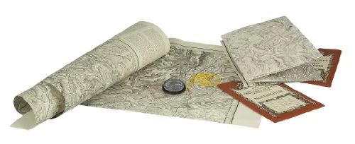
This series offers reprints of the first edition of the one-inch Ordnance Survey maps of England and Wales, dating from 1805 to 1900. Detail includes villages, hamlets, farms, county boundaries, roads and railways.
This series offers reprints of the first edition of the one-inch Ordnance Survey maps of England and Wales, dating from 1805 to 1900. Detail includes villages, hamlets, farms, county boundaries, roads and railways.
$4.50
Original: $14.99
-70%Ordnance Survey Maps—
$14.99
$4.50Description
This series offers reprints of the first edition of the one-inch Ordnance Survey maps of England and Wales, dating from 1805 to 1900. Detail includes villages, hamlets, farms, county boundaries, roads and railways.